DATA COLLECTION FOR TELECOM COMPANIES
GIS professionals use NAUTIZ X8 to collect data for telecom companies
Challenge
Collect precise utility pole measurement data outdoors in all weather conditions.
Solution
Use the Nautiz X8 rugged data collector to record and store data, display GIS files and navigate to utility pole sites.
Result
Improved productivity, enhanced accuracy and increased profits for GIS contractors and their clients.
Nautiz X8 rugged handheld helps GIS professionals calculate utility pole measurements for telecom companies.
GIS contractors are using Handheld’s Nautiz X8 rugged data collector to record utility pole measurements for telecommunications companies — and as a result they’re improving efficiency, saving significant time, and increasing profits.
In most cities, signing up for a new cable TV package is a quick process: instant activation over the phone, or an on-site appointment with a technician in a few days. That’s not because the technology is simple — it’s because the groundwork for a subscription is laid long before you ever sign up.
The process of adding a specific company’s equipment to a utility pole isn’t easy — before placement, companies have to submit applications in compliance with National Electrical Safety Code (NESC) regulations. These applications include more than a dozen unique measurements and calculations that help determine whether a pole can support the proposed attachments. To streamline the application process, telecom companies often hire GIS contractors to calculate these measurements for them.
Compact, powerful field data collection
William Stadler is an Oregon-based independent contractor for Orting, Washington, company
CelTec Communications, Inc. CelTec provides professional consulting, design and drafting services to the broadband and wireless industries.
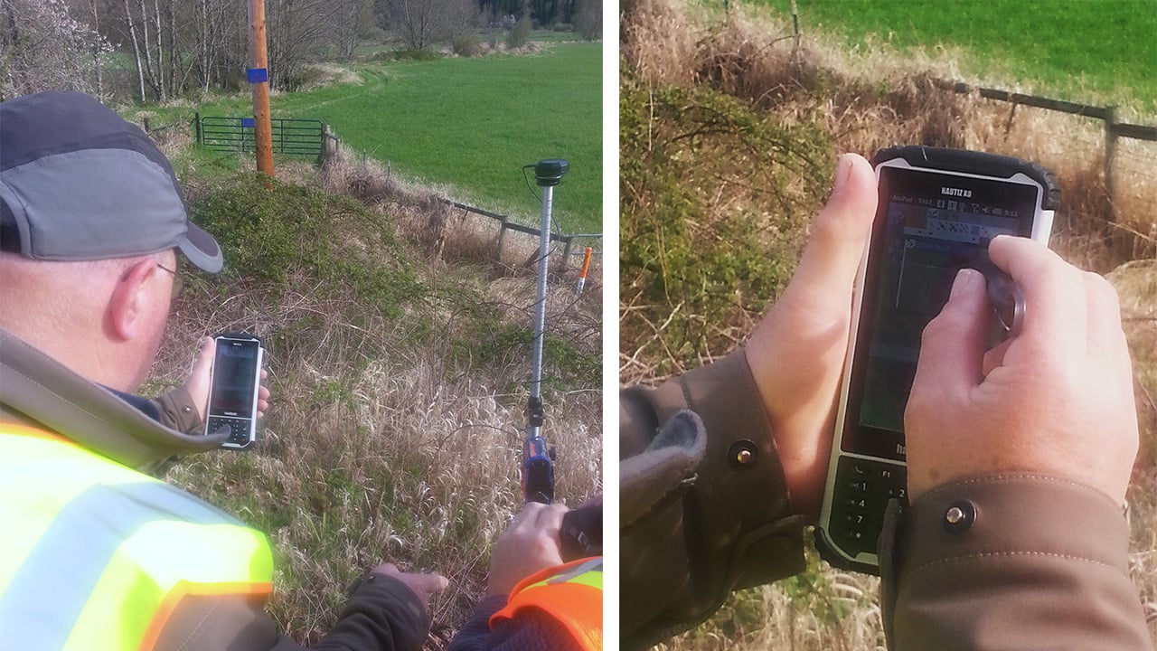
Stadler uses the Nautiz X8 to record information such as utility pole height, weight-bearing capacity, strand clearance, height and type of conductors, anchoring data and distance between neighboring poles. He operates the rugged data collector in conjunction with surveying equipment such as a range pole with a mounted GPS receiver, a telescoping measuring stick and a laser rangefinder.

“I stake the GPS-mounted range pole at the site of the utility pole and walk around with the Nautiz X8 making and recording measurements in ArcPad,” Stadler says. “For utility pole measurements I use a telescoping measuring stick or rangefinder to record conductor heights. The Nautiz X8 rugged PDA is small enough to throw in a belt pouch when I’m handling the measuring stick or laser, and easy to grab when it’s time to make entries.”
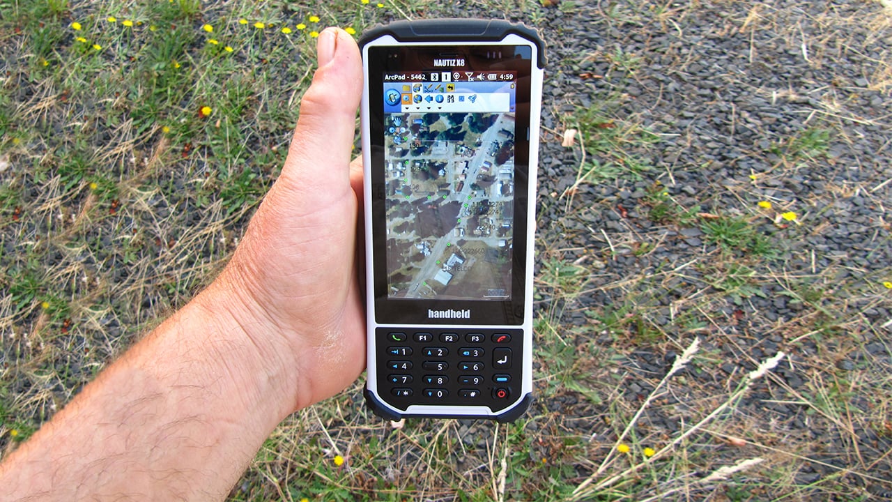
ESRI’s ArcPad Studio is a mobile field-mapping and data collection software program designed for GIS professionals. It uses GIS and GPS to capture, edit and display geographic information directly on the Nautiz X8’s screen.
Stadler worked with his GIS equipment provider, Tigard, Oregon-based Resource Supply, LLC, to build Quick Forms in ArcPad Studio, with around 20 different fields for recording measurements.
“I usually create these forms on a PC, but the Nautiz X8’s screen allows me to make them easily in the field if I need to,” says Jon Aschenbach, owner of Resource Supply. “Entering data into a Quick Form on the rugged handheld is very fast and easy. The big, clear screen makes data entry mistakes very rare.”
An ideal GIS solution for tough environments
Stadler used a pencil and printed paper forms to take notes in the field until 2012. Then he rented various GPS-equipped data collectors from Resource Supply between 2012 and 2014. When he learned that the Nautiz X8 was being developed, he “held off purchasing handhelds until it was released in 2015.”
“The combination of price, fast processing, excellent battery life and excellent screen made purchasing the rugged handheld an easy decision,” he says.
He calls the large, daylight-readable capacitive touchscreen “a delight” and “miles ahead of units I had previously used.” Other features that stand out to Stadler include the rugged data collector’s built-in 8-megapixel camera and its numeric keypad with three programmable buttons.
And of course, the handheld’s ruggedness was a necessity. Utility pole measurements are calculated in a variety of outdoor locations, from city streets to backcountry power transmission lines, in every conceivable weather condition.
The Nautiz X8 is a fully rugged handheld with IP67 and MIL-STD-810G specifications. That means it’s impervious to both dust and water and can survive repeated drops, strong vibrations and operating temperatures ranging from -22 to 140 degrees Fahrenheit.
Stadler explains, “The GIS data collector has fallen onto the ground, into a stream and from the roof of a moving vehicle, and has been used in subzero weather. I just pick it up, dust it off and keep working.”
The height of accuracy
As a GIS professional, GPS capability is extremely important to Stadler. He uses the Nautiz X8’s built-in u-blox GPS receiver to navigate to pole sites using geographical coordinates, and also to record strand and underground route information. To do this he captures a starting GPS point in ArcPad and walks the route, and the rugged PDA records path details in real time and saves the route at the final point.

When a client specifies sub-meter accuracy, Stadler uses a separate high-accuracy GPS receiver and external antenna that communicate flawlessly with the Nautiz X8 via BT 2.0.
“The Nautiz X8’s BT receiver is quite sensitive,” Stadler says. “I’ve walked away from the GPS receiver up to 150 feet and still had a connection. This is very handy when taking strand sag measurements halfway between the poles.”
Speed and endurance for a full workday
Processing power makes a big difference to Stadler.
“For William, time is money,” Aschenbach says. “The Nautiz X8 has saved him a huge amount of time while entering data and navigating through his work area.”
Stadler explains, “Other handhelds sacrifice processing power to save battery power. But this data collector’s processor handles very large ortho-rectified MRSID files with ease. There’s virtually no waiting for a map to refresh after panning and zooming. And there’s still battery power remaining after the advertised 12 hours of use.”
For Stadler, the Nautiz X8 beats out competing devices with a winning combination of compact size, generous screen real estate, processing power and battery life.
Put simply?
“There’s no going back to other units after using the Nautiz X8.”
